The Cartographer's Paradox: Fairy Rings and Mapmaking Traditions
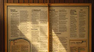
The air in my grandfather's workshop always smelled of beeswax and old paper. He was a cartographer, a meticulous craftsman who charted not just physical landscapes but also the subtle moods of the land. I remember, as a boy, watching him painstakingly ink a particularly challenging section of a Somerset map. The light from his drafting lamp caught the dust motes dancing in the air, illuminating the ancient accordions stacked in a corner - his father’s, his grandfather’s, each a silent witness to generations of mapmaking. He’s gone now, but the scent of his workshop, the echo of his quiet concentration, remains vividly present, inextricably linked to a fascination that continues to shape my own understanding of the world: the strange and sometimes unsettling relationship between land, legend, and the act of mapping.
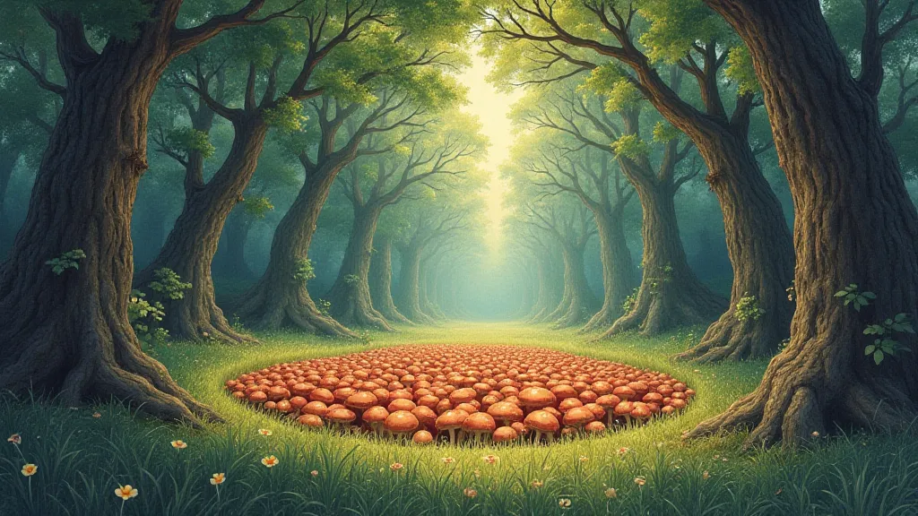
My grandfather never explicitly spoke about fairy rings—those uncanny circles of mushrooms that dot meadows and woodlands across Europe and beyond. But I recall his frustration, the tiny, almost imperceptible frown that would crease his brow when faced with unexplained anomalies on topographical surveys. These weren't errors, he’s assured me, just… things. Things that defied explanation, things that seemed to shift and shimmer just beyond the certainty of measurement. Looking back, I realize he was grappling with the unspoken cartographic paradox: the challenge of representing the mythical and ephemeral, the things that exist just beyond the reach of rational understanding, on a document designed to convey precision and order.

The Uncharted Territories of Belief
Historically, the incorporation, or deliberate omission, of folklore – and particularly beliefs surrounding fairy rings – into cartographic representations has been complex. Early maps weren't simply technical documents; they were often imbued with religious, social, and political significance. Medieval maps, in particular, frequently included fantastic creatures, symbolic representations of places, and elements drawn directly from popular legends. While specific fairy rings weren't commonly depicted (the fleeting nature of their appearance likely contributed to this), the underlying belief in the Otherworld, in places where the veil between realities was thin, profoundly influenced how landscapes were perceived and rendered. The forests themselves, often depicted as dense and impenetrable, weren't merely geographical features; they were portals, dwelling places for spirits and the Fae.
However, as cartography became more “scientific,” driven by the Renaissance emphasis on empirical observation and mathematical precision, there was a growing pressure to sanitize the landscape. The inclusion of mythical elements was deemed unprofessional, even dangerous. Maps became tools for land ownership, military strategy, and colonial expansion. Fantastical depictions were replaced with measured distances and standardized symbols. Yet, even in the most "accurate" maps, the ghosts of folklore lingered. Unexplained features, oddly shaped forests, or unnamed rivers sometimes retained a sense of mystery, a subtle acknowledgment of the unseen forces at play. It's theorized that certain ‘blank’ spots on older maps, areas deliberately left unmapped, could be attempts to obscure places held sacred or feared by local populations, areas where fairy rings were believed to be particularly potent.
Regional Variations in Legend and Representation
The folklore surrounding fairy rings varies considerably across Europe and beyond. In England, they are often associated with dancing fairies, and it was considered unlucky to disrupt a ring, lest you incur their wrath. Local lore often dictates specific behaviors to avoid while near a fairy ring – never step inside, never count the mushrooms, and certainly don’t try to dig them up (which, incidentally, can be extremely difficult due to the intricate network of mycelium beneath the surface). Similar beliefs exist in Ireland, Scotland, and Wales, often linking fairy rings to portals to the Otherworld or burial places of ancient peoples.
In Germany and Austria, fairy rings – known as “Hexenkreise” (witch’s circles) – are often associated with gatherings of witches and demonic rituals. This association, stemming from the witch trials of the early modern period, further solidified the perception of fairy rings as places of danger and otherworldly power. Across the continent, a common thread emerges: a deep-seated respect, often mingled with fear, for these enigmatic formations.
Interestingly, the absence of specific fairy ring depictions on historical maps isn’t universally true. In certain rural areas, particularly in Ireland and parts of Brittany, local mapmakers, operating outside the rigid confines of official cartography, might subtly incorporate references to folklore. These weren’t explicit representations, but rather oblique hints – a curiously shaped forest described as “the whispering woods,” a river marked with a symbol suggestive of a hidden entrance. These details often required a familiarity with local traditions to decipher, creating a layer of shared knowledge between mapmaker and viewer.
The Accordion's Echo: Craftsmanship and the Ephemeral
My grandfather’s accordions stand as a poignant reminder of the enduring connection between craftsmanship and a reverence for the ephemeral. Each button, each reed, represents hours of meticulous labor, transforming raw materials into a source of beauty and music. Restoring these instruments – painstakingly cleaning the bellows, replacing broken keys, tuning the reeds – is a process of uncovering history, of breathing new life into objects imbued with the echoes of past generations. The meticulousness required mirrors that of cartography - the need for precision, the understanding of materials, and the respect for the enduring power of legacy.
Similarly, the fleeting existence of fairy rings demands a certain humility, a recognition that our understanding of the world is always incomplete. They appear and disappear, their presence dictated by factors beyond our control – moisture levels, soil composition, the complex interplay of mycorrhizal networks. To attempt to permanently map them would be futile, to deny their very essence. Perhaps the most appropriate cartographic approach isn’t to depict them literally, but to acknowledge their presence through a sensitivity to the land, a willingness to recognize the places where the veil is thin, where the echoes of the Otherworld linger.
Looking at old maps now, I see them not just as documents of physical terrain, but as reflections of human beliefs, fears, and aspirations. The absence of fairy rings isn't necessarily a sign of progress, but rather a consequence of a shifting cultural landscape, a growing disconnect from the natural world. As we navigate the complexities of the modern era, perhaps it’s time to rediscover the wisdom of those who recognized the power of the unseen, who understood that the most accurate map isn’t always the most complete.